The core premise of “route planning” in any GPS app is to place anchor points representing fixed destinations, or where you would like to go, on a forthcoming adventure, and a good route planner should also have the ability to show you the most viable way.
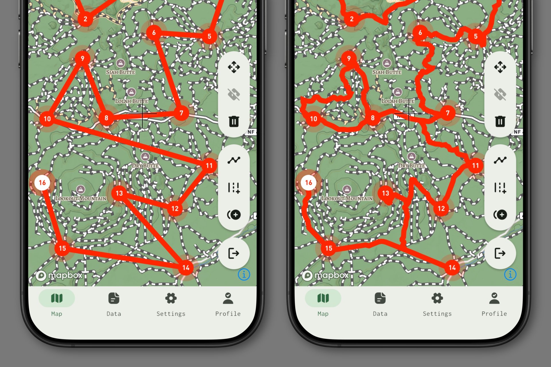
In its most basic form, our planner grants you the ability to place points, and simple, straight line segments will be drawn between them. This might be how you prefer to visualize routes, so we’re keeping this basic functionality in place. However, you also have the ability to enable wayfinding per segment, which shows the best way to get from point A to point B based on a particular mode of travel.
Wayfinding isn’t new functionality in our app, but before this past week’s improvements, it was slow, and often stymied by minor road transitions, breaks in the source data, or inaccurate point placement. Now, it utilizes a much faster and more robust API that is far more forgiving and consistently yields great results!